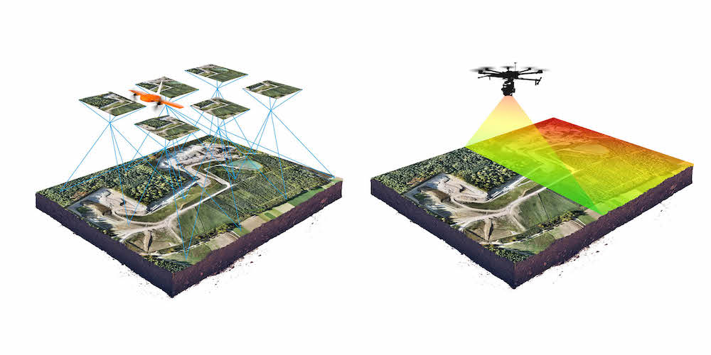
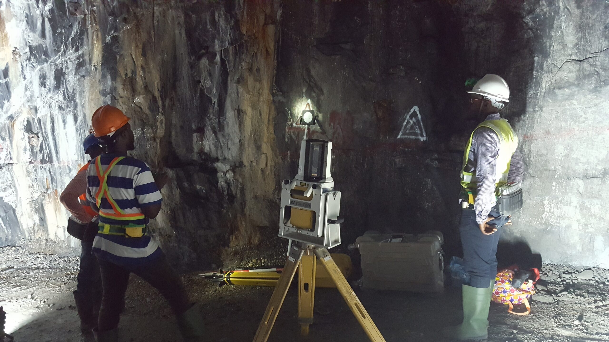
A-M Surveys Limited is happy to be the leading firm in Ghana with expertise in LIDAR technology Surveys. We have modern 3D Laser scanning devices and UAV mounted LIDAR at our disposal, hence the highest form of data quality is assured. The 3D laser scanners enable the capture of high precision data for a wide range of areas especially inaccessible areas and potentially dangerous sites like landslide areas, mining pits walls, tailings sites, motorways, etc.
We apply this technology solutions is applied in the following areas: